Picture starting your day with a quick walk to coffee, biking to work or class, and catching a public art installation on the way home. If you want an in-town lifestyle in Bloomington with easy access to downtown, the B-Line Trail belongs on your shortlist. You care about convenience, value, and feeling at home in a neighborhood that fits your routine. In this guide, you’ll learn what living near the B-Line really looks like, the housing options you’ll find, how to weigh tradeoffs, and what to check before you buy. Let’s dive in.
What the B-Line offers
The B-Line Trail is an urban multi-use path that functions like a linear park and active transportation corridor through the heart of Bloomington. It links downtown to nearby neighborhoods and destinations, combining pedestrian and bicycle circulation with public art and streetscape improvements. For an official overview and maps, explore the City Parks & Recreation resources on the City of Bloomington website.
You’ll see the trail used throughout the day for commuting, jogging, dog-walking, and weekend recreation. It also serves as a backdrop for public art and community happenings. For event listings and seasonal highlights near the corridor, check the Visit Bloomington events calendar for current dates and locations.
Everyday convenience and commute
Living within a few blocks of the B-Line can reduce how often you need your car. You can walk to cafés, restaurants, fitness studios, and downtown businesses. Many residents also use the trail to reach Indiana University facilities or to connect with bus routes for a multimodal commute. If you rely on public transit, review nearby routes and schedules on Bloomington Transit to map out realistic door-to-door times.
Trails also support healthy routines. Research from the Rails-to-Trails Conservancy shows that access to safe paths increases opportunities for regular physical activity and community interaction. If staying active is a priority, living near the B-Line can make it easier to build movement into your day.
Housing near the trail
You’ll find a mix of homes within a short walk of the B-Line. Options range from downtown condos and loft conversions to infill townhomes and older single-family homes in established neighborhoods. Here’s how each type tends to fit different needs:
- Downtown condo or loft: Low maintenance and high walkability, often with building amenities. Expect HOA fees that typically cover exterior maintenance, common areas, and insurance. Review rental restrictions if you plan to rent your unit.
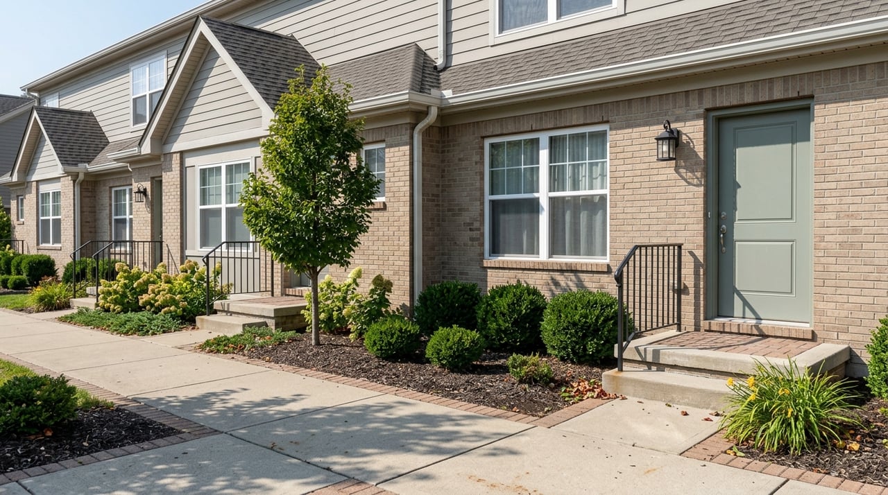
- Townhome or rowhouse: More space and often a garage, still with an HOA. Good balance for those who want urban convenience without a full single-family yard.
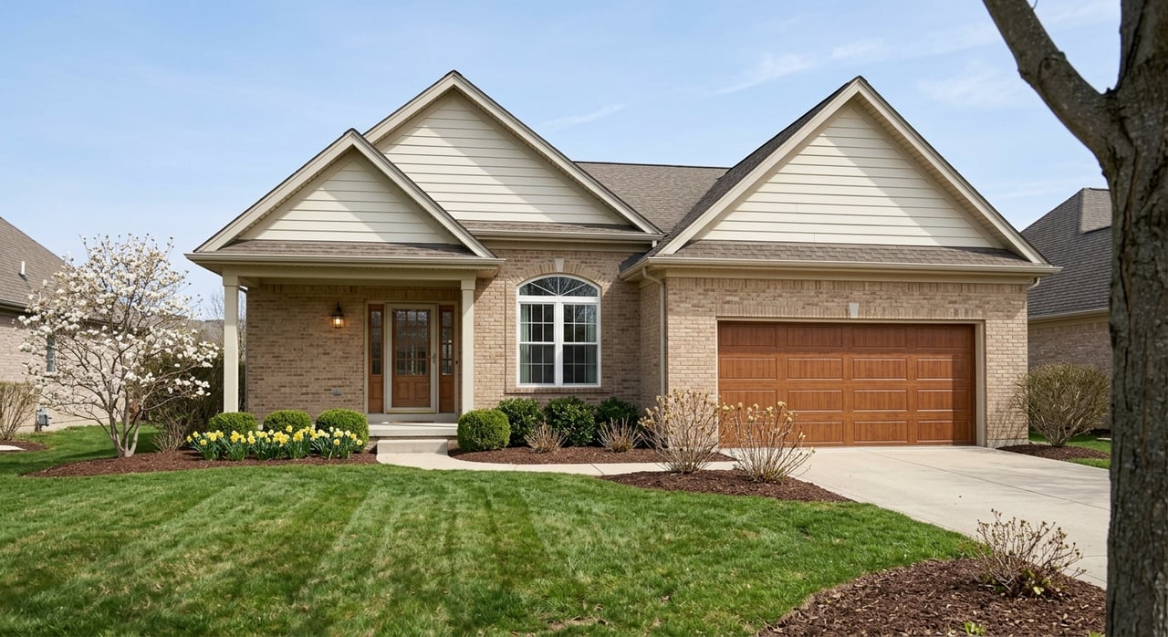
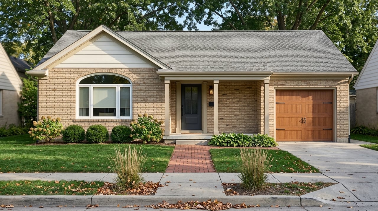
- Nearby single-family home: Often larger lots and more parking, still within biking distance to downtown and IU. Homes closest to the trail may see more foot traffic and event activity.
If you’re assessing value, look at recent comparable sales for condos and townhomes within 0.5 to 1 mile of the trail, then compare to more suburban areas. Proximity to downtown often commands a premium for convenience, though you should verify current trends with up-to-date local data.
Proximity bands to compare
It helps to think in simple distance bands when you tour:
- Immediate: 0 to 0.25 miles, roughly a 5-minute walk. You’re right on or crossing the corridor. Expect the highest walkability and occasional event spillover or evening activity.
- Short walk: 0.25 to 0.5 miles, about 5 to 10 minutes on foot. A common zone for single-family homes and small multi-family buildings. Many buyers find this a sweet spot for quiet and convenience.
- Nearby: 0.5 to 1 mile, around 10 to 20 minutes walking or a short bike ride. You may find larger lots, more parking, and a neighborhood feel while staying close to downtown and IU.
During showings, stand outside for a few minutes to gauge foot and bike traffic. Revisit at different times of day, especially evenings and weekends, to get a full picture of noise and activity.
Parking and transportation tips
Parking can be limited near downtown and older neighborhoods. If a condo or townhome lists a space count, confirm whether spaces are deeded, assigned, or first-come. If you plan to rely on on-street parking, check local rules for that specific block and ask about permit requirements. For cyclists, look for secure storage options either on site or nearby.
If you commute by bus, locate the nearest stops and plan a test commute using Bloomington Transit schedules. For an address-level look at walkability and transit convenience, plug the home’s address into Walk Score to compare options side by side.
Quality of life and safety
Trail-adjacent living adds easy access to green space and public art. You should also think about practical items like lighting and winter maintenance. The City’s Parks & Recreation pages outline park and trail information, which is helpful for understanding how the corridor is maintained. Start with the City of Bloomington Parks page for trail and park resources.
If safety is top of mind, review community resources and statistics from the Bloomington Police Department. As with any in-town location, visit the area at various times and talk with your agent about neighborhood patterns that matter to your routine.
Schools and district context
Homes in central Bloomington are served by the Monroe County Community School Corporation. Always verify specific school assignments by address through the district. Since boundaries can shift, confirm any school-related plans during your inspection period and before your final decision.
Due diligence checklist
Use this quick list to evaluate properties near the B-Line like a pro:
- Walkability and transit: Check Walk Score, bike routes, and Bloomington Transit stops for the exact address.
- Commute mapping: Measure walking, biking, and driving times to work, IU, grocery stores, and downtown.
- Parking: Confirm the number of dedicated spaces, garage condition, HOA parking rules, and any local permit requirements.
- HOA documents: Review fees, reserves, insurance coverage, rental restrictions, pet rules, and any special assessments.
- Zoning and land use: Ask your agent to review city zoning for nearby infill or commercial uses that could change noise and traffic.
- Trail proximity tradeoffs: Visit during peak hours and events. Listen for noise, assess privacy landscaping, and note evening lighting.
- Safety: Review resources from the Bloomington Police Department and discuss neighborhood context with your agent.
- Property data: Verify taxes, lot details, and parcel info with Monroe County resources at the county government site.
- Floodplain and environment: Use Monroe County GIS to understand any low-lying areas or drainage patterns around the property.
- Resale and rental demand: Compare recent comps and discuss long-term value, and if investing, confirm local rules for short-term and long-term rentals.
Events and culture along the corridor
The B-Line is part of Bloomington’s downtown experience, connecting you to shops, breweries, theaters, and cultural venues. Public art along the trail changes the feel of a simple walk or ride. Recurring events downtown, including the farmers’ market and local festivals, draw people into the corridor on weekends. To see what’s happening during your visit, browse the Visit Bloomington events calendar.
Who is a good fit
If you want a walkable routine, shorter trips for errands, and easy access to downtown, living near the B-Line is a strong match. Young professionals often favor condos or townhomes for low maintenance and location. Buyers who want more space and parking tend to look a half mile to a mile out, where single-family homes offer yards but still keep you close to the trail.
Families looking for a balance between convenience and quieter streets often find that short-walk band appealing. If you plan to rent part-time or eventually convert a home to a rental, proximity to IU and downtown employers can support demand. Review any HOA and local rules before you make plans.
Work with a local guide
Choosing the right spot near the B-Line is about more than a quick walk to coffee. It’s about your commute, the feel of the block, HOA tradeoffs, and long-term value. You deserve a guide who knows the corridor and can streamline your search. If you want a targeted home tour, address-level walkability checks, and help weighing condo versus single-family tradeoffs, reach out to Amanda Richardson to Schedule a Free Consultation.
FAQs
How walkable is living near Bloomington’s B-Line?
- Homes within a few blocks are very walkable for errands and downtown access, but you should confirm the exact address using tools like Walk Score and a test walk.
What home types are close to the B-Line Trail?
- You’ll commonly find downtown condos and lofts, infill townhomes, and nearby older single-family homes, each with different tradeoffs for space, parking, and HOA rules.
Is parking difficult near downtown Bloomington?
- It can be, especially close to the trail and core downtown; verify off-street spaces, on-street rules, and any permit needs for your specific block or building.
Do homes near the B-Line rent easily in Bloomington?
- Many do because of proximity to IU and downtown employers, but you should review current rental listings, vacancy trends, and any HOA or local regulations before investing.
What are the downsides of living right on the trail?
- Expect higher pedestrian and bike traffic, occasional event crowds, limited private outdoor space for some homes, and HOA fees for condos and townhomes; visit at multiple times to assess fit.